WELCOME to THE GREEN HISTORY DETECTIVES
Episode 38
The buttons above images are identified and described below:
BUTTON
DESCRIPTION
<<BACK
Go Back to the previous image in the set
NEXT>>
Go to the Next image in the set
ZOOM IN
Zoom into image
NORMAL
Restore image to initial size
ZOOM OUT
Zoom out of image
Repeating an operation is most effectively performed by clicking
on a button and then pressing the enter key repeatedly as desired.
Panning is most effectively performed by using the cursor keys.
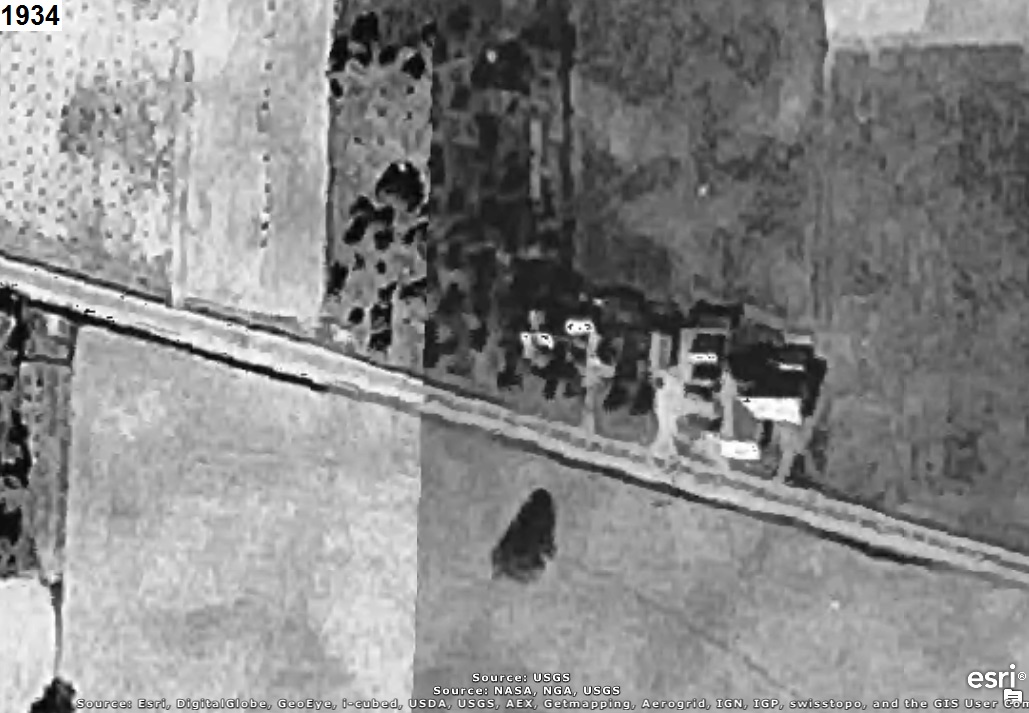
Who can tell us what the area in the aerial photograph(s) below is of?
The year that each aerial photo was taken is given in the upper left corner of the photo.
The clues will consist of adding another aerial photo of a later year to the set.
CLUE #1:
It's green there.
CLUE #2:
CAUTION!!!
WARNING!!!
ALERT!!!
The solution is given below.
DO NOT scroll down further
UNLESS you would like to see the solution.
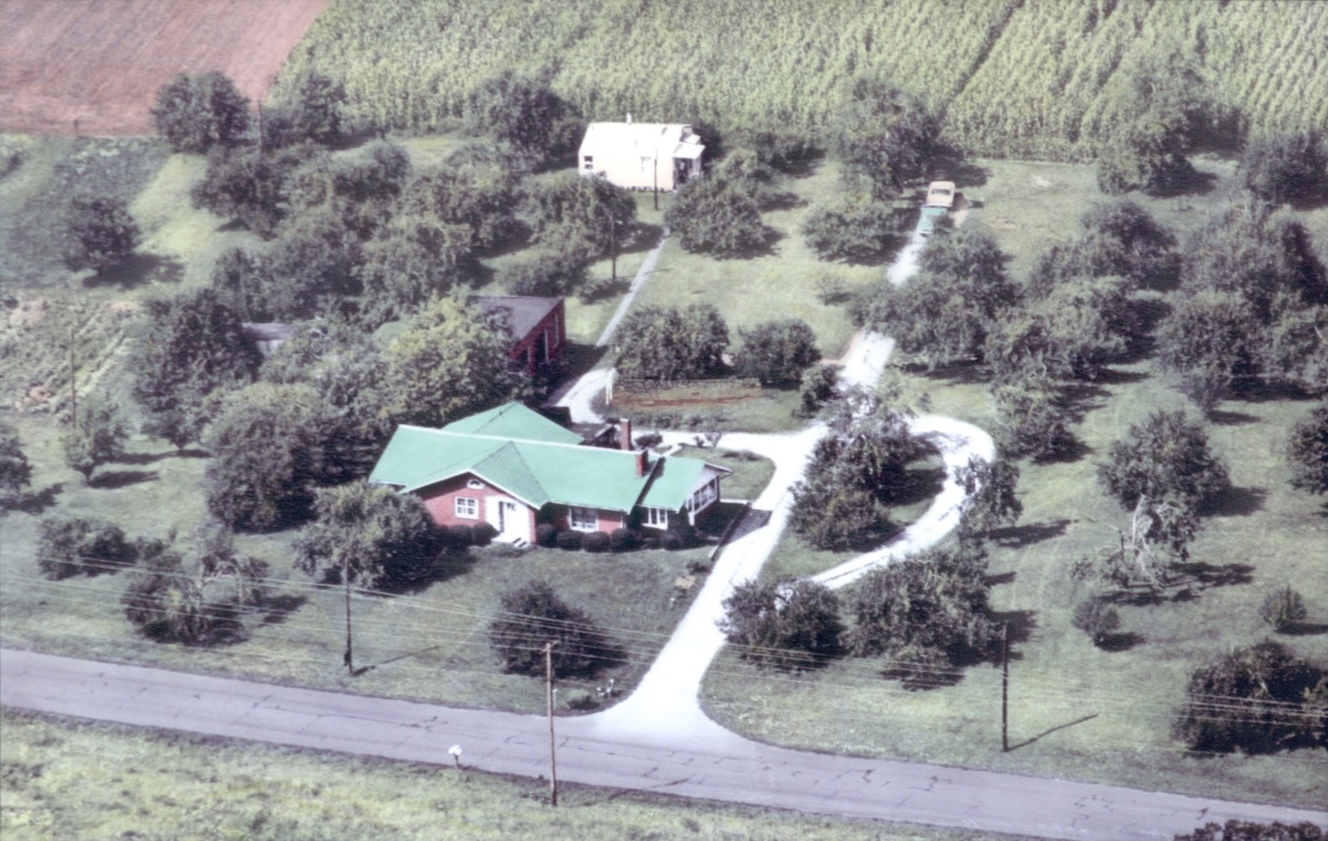
SOLUTION
It's
PONTIUS GREEN ACRES in Hartville, Ohio as shown in the 1968 aerial photograph below:
Pontius Green Acres had a large variety of trees including many varieties of Apple, Peach, Pear, Plum, Chestnut, and Cherry.
The garden included Sweet Corn, Green Beans, Carrots, Peppers, Onions, Squash, Cabbage, Tomatoes, Strawberries, and more.
Folks from Hartville and surrounding areas enjoyed fruits, vegetables, Cider, and Honey from Pontius Green Acres for many years.
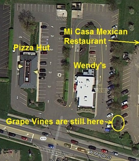
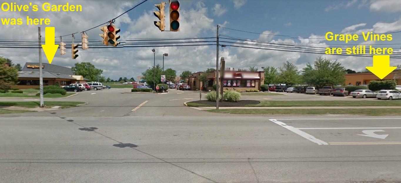
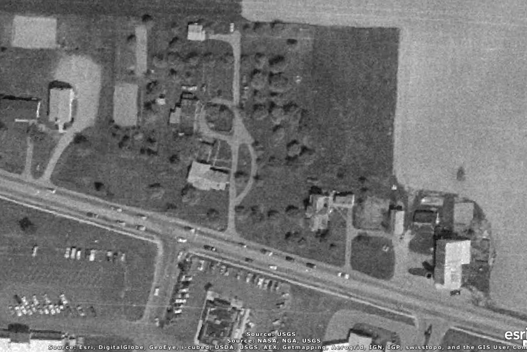
A recent aerial view of the area above is shown below. Note that the Grape Vines are still there!
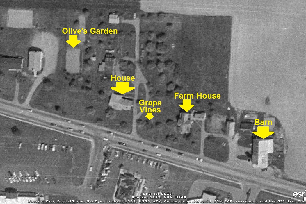
A 1985 aerial photo of Pontius Green Acres with the Farm House and Barn are shown below.
Wendy's is located where the red brick house (with green roof) was located.
Pizza Hut is to the west (left) were Olive's (Mrs. Pontius) Garden was located.
Mi Casa (previously Arby's) is to the east (right) where the Farm House was located.
Chase Bank (previously Ponderosa) is to the east (right) of that and just to the east (right) of
that is where the Barn (see THIS OLD BARN) was located.
A Google Maps Car photo from August 2011 is given below.
The aerial photo below includes a white rectangle to identify the area in the aerial photos at top.
The then (1985) and now (recent) aerial photographs below have been lined up precisely at the
northeast corner of the Burger King building.
As can be seen, the entrance to the main porch on the east side of the house is exactly where the
southeast corner of the Wendy's building is now located.
Also, the northwest corner of the Pizza Hut building is exactly in the middle of Olive's Garden.
The aerial photo below includes a white rectangle to identify the area in the aerial photos above.
The author of this web page, who is a grandson of Mr. and Mrs. Pontius, thinks it would be great if
Olive Garden Restaurant put a restaruant of theirs where the Pizza Hut is now located, which is
precisely where the Olive (Pontius) Garden was located.