WELCOME to
THE GREEN HISTORY DETECTIVES
Episode 63

The buttons above images are identified and described below:
     BUTTON    DESCRIPTION
     ZOOM IN    Zoom into image
     NORMAL    Restore image to initial size
     ZOOM OUT    Zoom out of image
Repeating an operation is most effectively performed by clicking
on a button and then pressing the enter key repeatedly as desired.
Panning is most effectively performed by using the cursor keys.

All other Episodes are available at THE GREEN HISTORY DETECTIVES


Episode 63

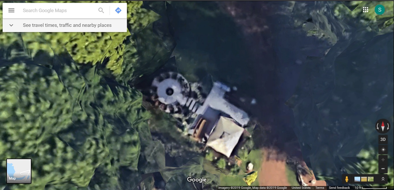
Who can tell us what is written upon the sign (?) in the Google Maps aerial view map below and where that sign (?) was once displayed?

Please also see: Summary of Crimes and Ohio Criminal Justice System Corruption with Individuals Involved


Clue #1:

A clue is provided in the small map in the lower left corner of that Google Maps map.


Clue #2:

Final Clue.


Clue #3 (Bonus Clue):

It was once known as "Kensington Lake".


CAUTION!!!

WARNING!!!

ALERT!!!

The solution is given below.

DO NOT scroll down further

UNLESS you would like to see the solution.


SOLUTION


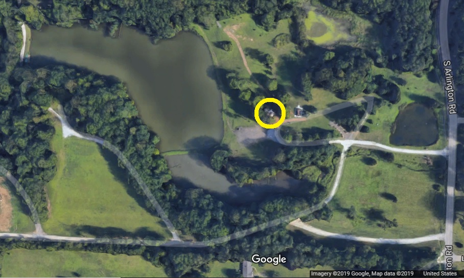
The sign is located in the yellow circle in the Google Maps aerial view map below, at what was formerly 'Pine Valley Lake Park', 'Bob's Lake', and evidently 'Kensington Lake'.
However, we still do not know what is written upon that sign. Perhaps the owner or a friend of the owner will inform us.
Or, maybe someone with a drone equipped with a camera can do a fly over and relay that information to us?
The position is: Latitude N40°56'11.3" / Longitude W81°29'53.4"

You may see the map and zoom and pan within that map at Google Maps map at 'Pine Valley Lake Park'.


AmazingCounters.com