WELCOME to
THE GREEN HISTORY DETECTIVES
Episode 39

The buttons above images are identified and described below:
     BUTTON    DESCRIPTION
     <<BACK    Go Back to the previous image in the set
     NEXT>>    Go to the Next image in the set
     ZOOM IN    Zoom into image
     NORMAL    Restore image to initial size
     ZOOM OUT    Zoom out of image
Repeating an operation is most effectively performed by clicking
on a button and then pressing the enter key repeatedly as desired.
Panning is most effectively performed by using the cursor keys.

All other Episodes are available at THE GREEN HISTORY DETECTIVES


Episode 39

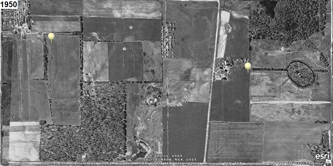
Who can tell us what city is supposed to be located at one of the two yellow markers in the aerial
photograph(s) below?
The year that each aerial photo was taken is given in the upper left corner of the photo.
The clues will consist of adding another aerial photo of a later year to the set.


ADDITIONAL CLUE:

The aerial photos are oriented with north to the right (i.e. west is up) to use the computer screen
most effectively.


CAUTION!!!

WARNING!!!

ALERT!!!

The solution is given below.

DO NOT scroll down further

UNLESS you would like to see the solution.


SOLUTION


It's supposed to be where the City of New Franklin is, which according to the research at
These Are The 10 Most Boring Places In Ohio is the most boring place in Ohio.
Note that Green, which is right next to New Franklin, was awarded second place for the most boring
place in Ohio.

According to Wikipedia, New Franklin is located at: Latitude 40.950856, Longitude -81.539205.
According to Google, the City is located at: Latitude 40.941728, Longitude -81.541509.
Both of those locations are out in a field.
However, the City of New Franklin Administrative Assistant believes it is at "the intersection of State
Route 93 (Manchester Road) and Center Road, which is the location of the City's Offices
".

The aerial photo below includes a white rectangle to identify the area in the aerial photos above
and a green rectangle to identify Green.
Wikipedia indicates the city is located at the upper right red marker.
Google indicates the city is located at the lower right red marker.
The City Administrative assistant, believes the square is located at the lower left red marker
near the City's Offices which are located at the upper left red marker:


hitwebcounter.com