WELCOME to
THE GREEN HISTORY DETECTIVES
Episode 4
NOTE: The set of buttons above an image allow you to Zoom In and Out of the image.
Zooming is most effectively performed by clicking on 'ZOOM IN' or 'ZOOM OUT'
and then pressing the enter key repeatedly as desired.
Panning is most effectively performed by using the cursor keys.All other Episodes are available at THE GREEN HISTORY DETECTIVES
Episode 4
Who can tell us where the photo below was taken?
NOTE: This may serve as an excellent demonstration that humans really are smarter than computers and, in this case, even faster at finding the solution than computers! 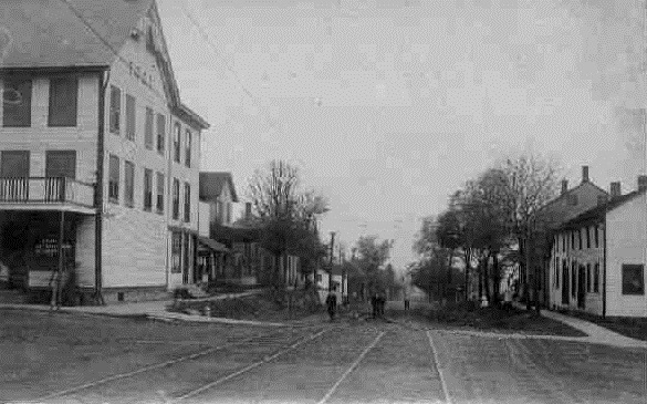
CAUTION!!!
WARNING!!!
ALERT!!!
The solution is given below.
DO NOT scroll down further
UNLESS you would like to see the solution.
SOLUTION
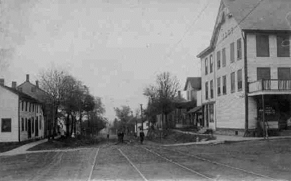
The old photo was taken in Greentown looking north from the intersection at Cleveland Avenue NW and State Road NW. The Google Search by Image could NOT find that image because I flipped the image horizontally. We humans are able to automatically compensate for such things during recognition but computers will get stuck out in the weeds, unless programmed to also consider the possibility that an image was flipped (horizontally) and/or flopped (vertically). Below is the original photo before being flipped:
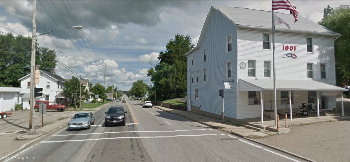
The photo below was taken by the Google Maps Car at about the same spot in August 2011:
Is it possible that the tracks in the old Greentown photo above connected to the Streetcar tracks in Canton as shown in the photo below from 1910?
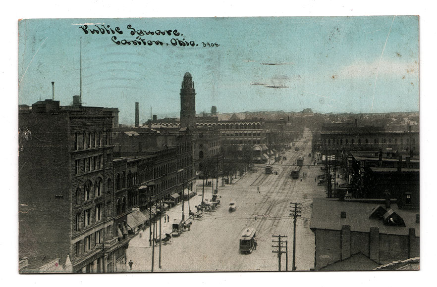
Yes it is. As documented by the Green Historical Society:
From the 1880’s through the 1940’s, streetcars and interurban railcars connected northeast Ohio in a way that is hard to imagine now. Larger cities often had multiple competing streetcar systems, and interurban rail systems connected the cities and the towns that weren’t large enough for their own systems. Cleveland, Akron, Canton, Massillon and New Philadelphia were all interconnected. A line was graded from Akron south along the east edge of the Portage Lakes, crossing South Main just north of Caston Road, continuing through what is now Nimisila Reservoir, and to Comet between Main and Stoner Streets. A little south of Comet, the line branched to the east to Canton, to the west to Massillon.
Sadly, just before grading was completed and rails laid, the company (NOT&L - Northern Ohio Traction & Light) bought its competition, which had just opened a line from Akron southeast through Springfield, Uniontown, GREENTOWN, and on to Canton. The line through Comet, called the Akron Canton & Massillon Railroad, lay dormant for years, with pieces of the right-of-way gradually sold. Much of it is marked by electric transmission lines. While the land was in limbo, it became known as "the world’s longest potato patch", because farmers were hesitant grow anything else or to farm and improve it as it could be claimed by the railroad at any time.
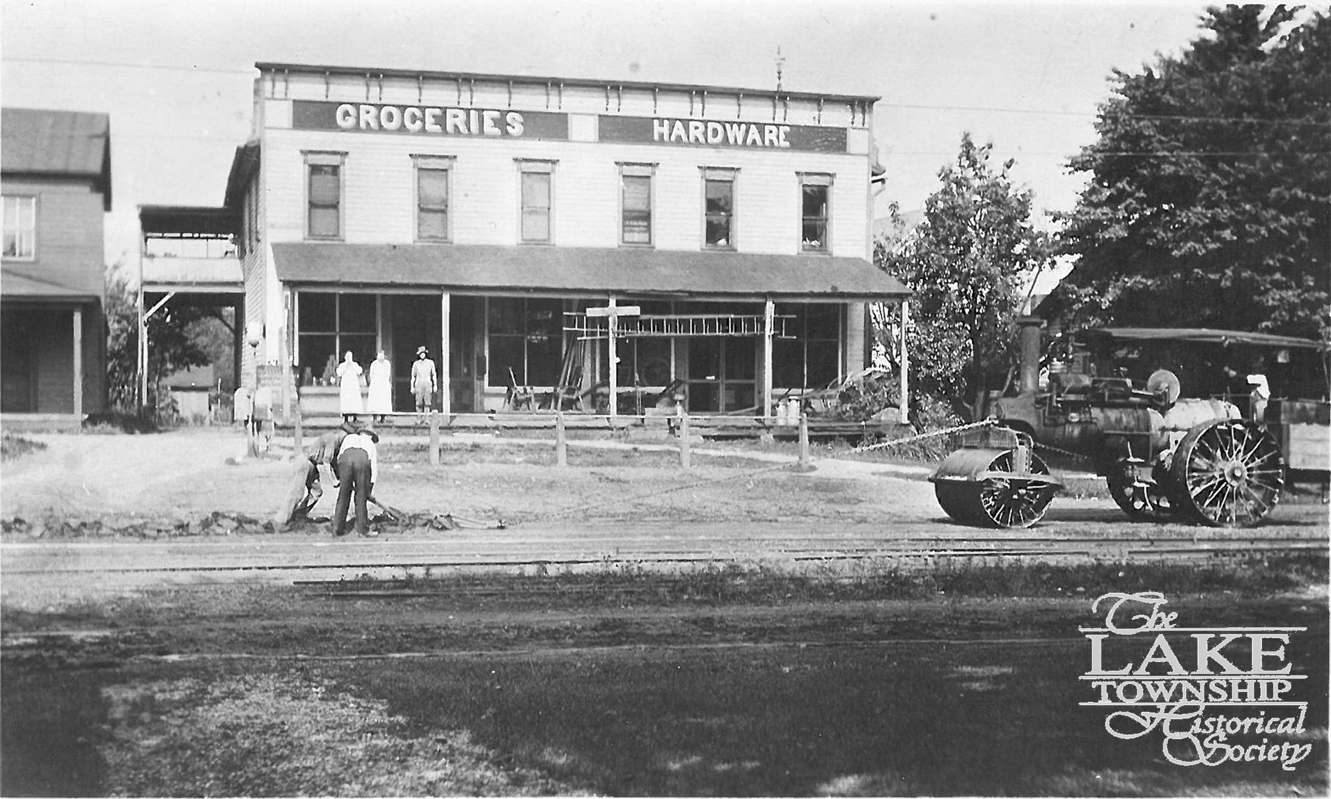
And, evidently, the photo below of Uniontown from (I believe) 1915 (with the steam roller to the right) shows the very same Streetcar tracks that are connected to those in Greentown in the first photo above:

<>