Hello City of Green and Green Historical Society:
Thank you all for your responses and information about the original location of the Lichtenwalter
Schoolhouse that was established in 1885 and was moved to Boettler Park in the late 1970’s.
I received, from the City of Green, the schoolhouse map from the Green Historical Society that was
part of an earlier landmark designation review.
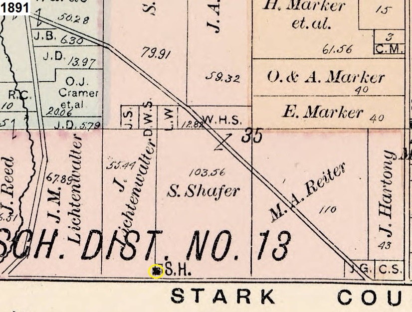
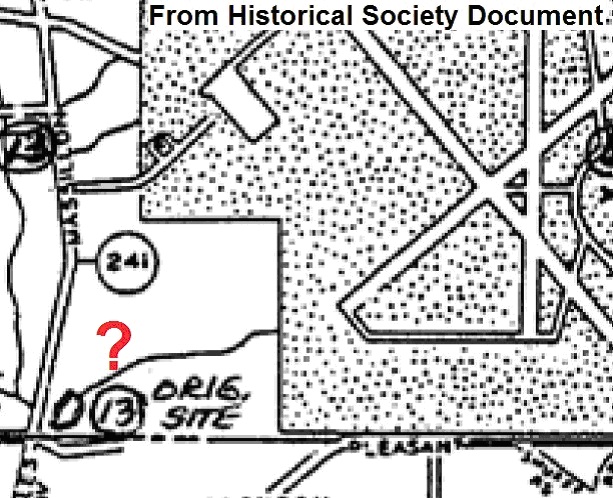
That landmark designation map indicates that the Lichtenwalter Schoolhouse was originally located
just east of the pond at the northeast corner of Massillon and Mount Pleasant Roads where the
number 13 is circled below (below the added red question mark):
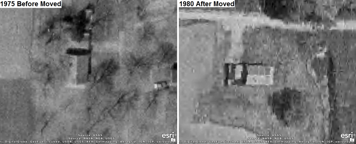
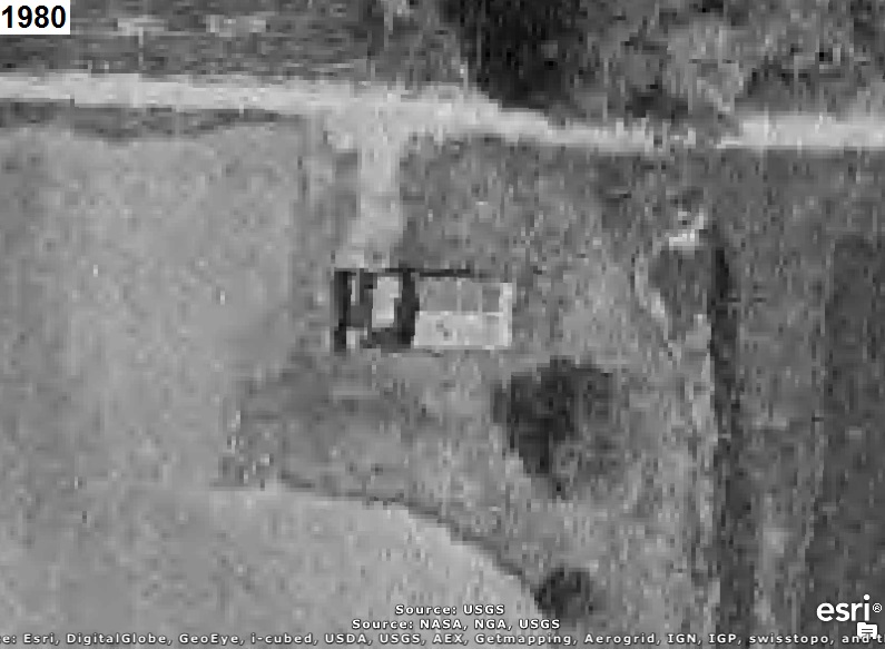
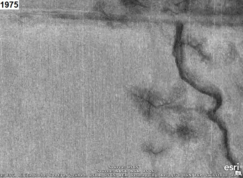
We know from 1975 and 1980 aerial photos that the schoolhouse was moved from the original location
on Mount Pleasant Road to the present location at Boettler Park on Massillon Road some time between
1975 and 1980.
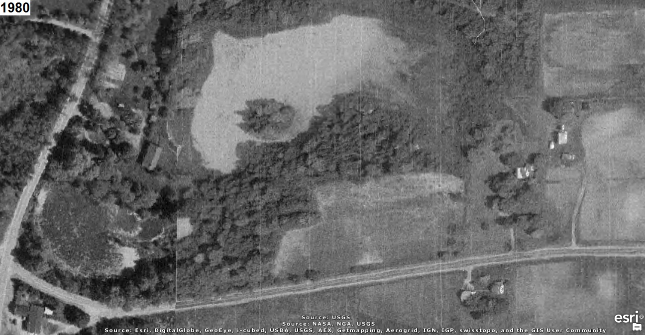
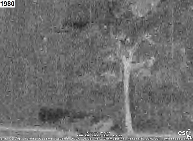
The 1980 aerial photo below shows the present location of the schoolhouse after it was moved to
Boettler Park at Latitude: N40° 55’ 05.43”, Longitude: W81° 27’ 54.33”:
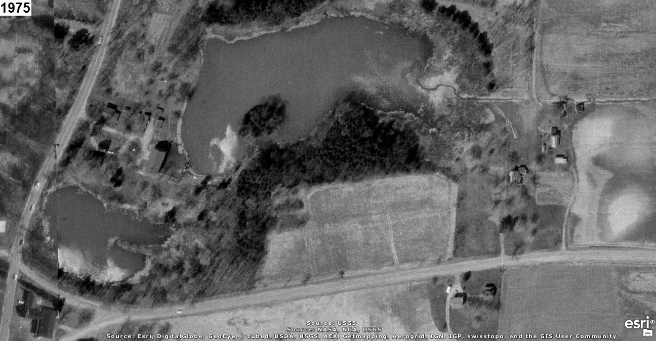
The 1975 aerial photo below shows that same location before the schoolhouse was moved:
However, the 1975 and 1980 aerial photos below, which show the northeast corner of Massillon and
Mount Pleasant Roads, do not show a building there in 1975 (before the schoolhouse was moved) and
then not there in 1980 (after the schoolhouse was moved):
To determine exactly where the Lichtenwalter Schoolhouse was originally located, maps from 1891 and
1910 and aerial photos taken in 1934, 1942, 1950, 1958, 1965, 1972, 1975, and 1980 were closely
examined. The maps are available on the Summit Memory Online Map Room web page at
http://summitmemory.com/cdm/onlinemaproom.
The 1891 map below shows the schoolhouse located at the yellow circle, which is about half way
between Massillon Road and Koons Road (the diagonal road) on the north side of Mount Pleasant Road:

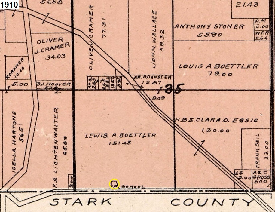
The 1910 map below shows the schoolhouse located at the yellow circle, which is also about half way
between Massillon Road and Koons Road on the north side of Mount Pleasant Road:
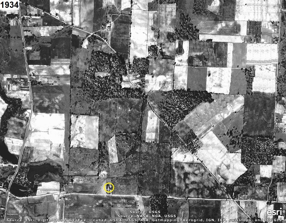
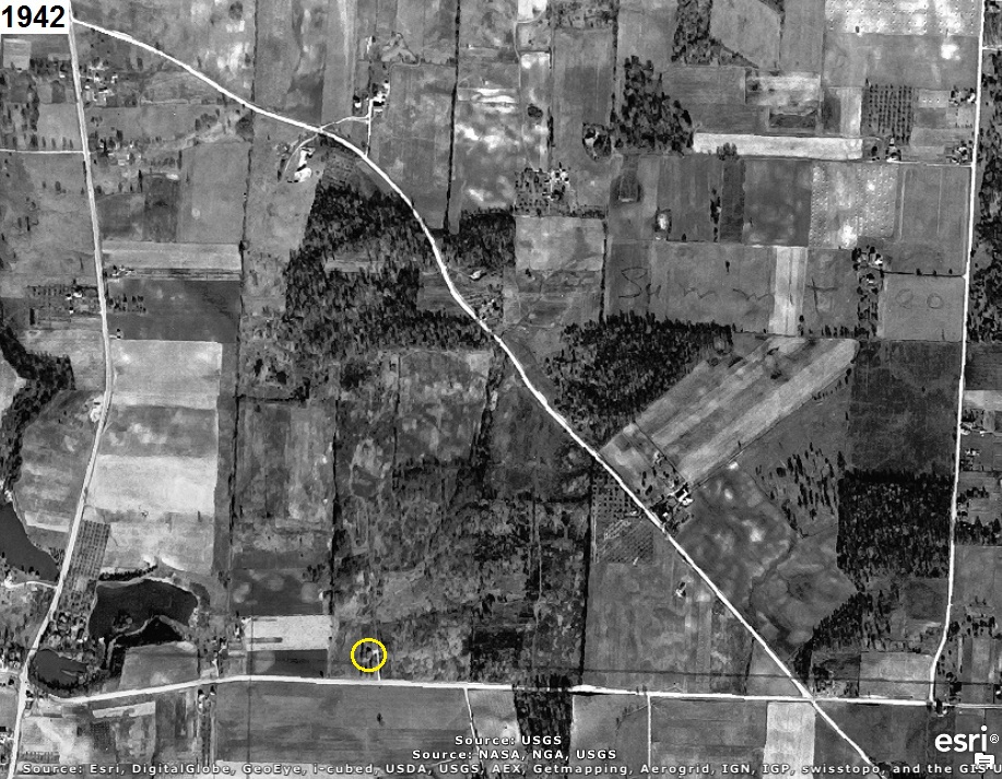
The 1942 aerial photo below (as well as 1934, 1950, 1958, 1965, 1972, and 1975 aerial photos) shows
the schoolhouse located at the yellow circle, which is about half way between Massillon Road and
Koons Road on the north side of Mount Pleasant Road at Latitude: N40° 54’ 29.17”, Longitude: W81° 27’ 17.54”.
This is considerably farther east than as indicated on the landmark designation map.
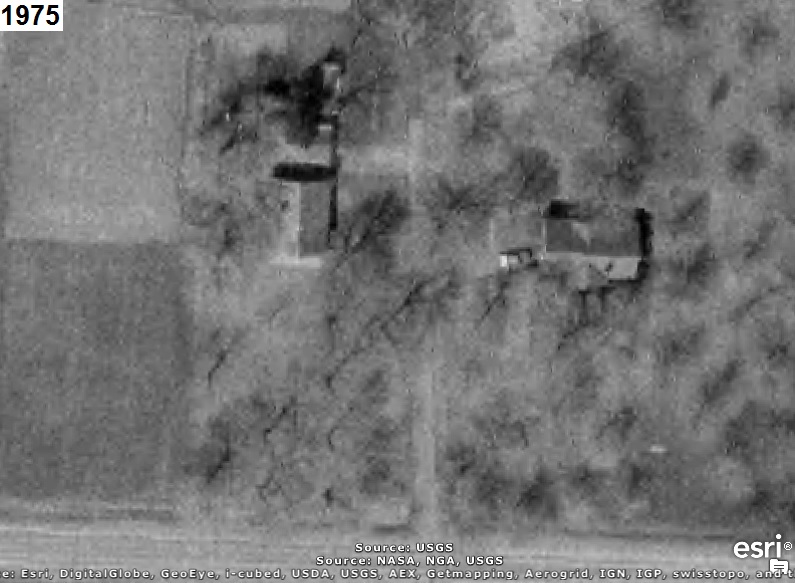
The 1975 aerial photo below shows the original location of the schoolhouse (left building at
Latitude: N40° 54’ 29.17”, Longitude: W81° 27’ 17.54”) about half way between Massillon Road and Koons
Road on the north side of Mount Pleasant Road before the schoolhouse was moved:
The 1980 aerial photo below shows that same location after the schoolhouse was moved:
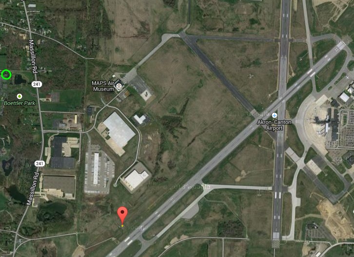
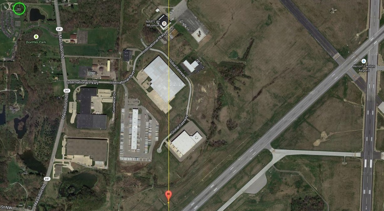
The recent aerial photo below shows the original location of the schoolhouse at the red marker
(and yellow point), which is approximately 200 feet left of the Touchdown Zone of Runway 5 at the
Akron/Canton Airport (FAA Identifier: CAK), and the present location of the schoolhouse in the
green circle at Boettler Park:
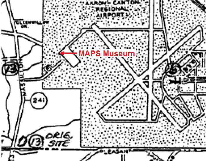
If to proper scale, we should be able to determine where on the landmark designation map that the
schoolhouse was originally located by the intersection of two lines. One line may be Mount Pleasant
Road because the schoolhouse was located on the north side of Mount Pleasant Road, which is
identified on that map below along with several other points including the Military Aviation
Preservation Society (MAPS) Museum, which is identified at the red arrow. Notice that the two
runways (01/19 and 05/23) have been extended south and southwest since the map was created.
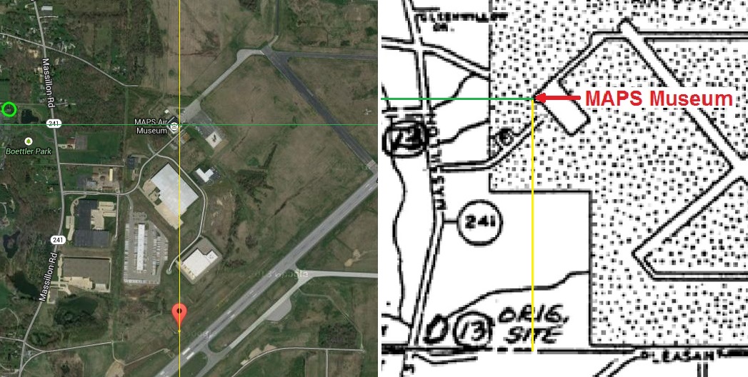
If aerial photos and maps are to proper scale and are oriented with north directly north and up, we
can determine an unknown longitude at one point by knowing the longitude of other points that are
directly north or south of that point. The Google Maps aerial photo below includes a red marker and
yellow dot at the original location of the schoolhouse, a yellow vertical line at that point, and a
green circle where the schoolhouse is currently located. We can see that the east corner of the
MAPS Museum is directly north of that marker, as shown on the yellow line:
If the landmark designation map is to proper scale, we could conclude that a line drawn directly
south from the MAPS Museum on that map to Mount Pleasant Road identifies where on Mount Pleasant
Road that the schoolhouse was originally located. Unfortunately, the landmark designation map is
not to precise scale and the Airport diagram is not located precisely on that map. For example, we
can see in the aerial photo below (left) that the latitude of the MAP Museum is less than (i.e.
south of) that of the present location of the schoolhouse in the green circle; however, the
landmark designation map below (right) indicates the latitude of the MAP Museum is greater than
(i.e. north of) that of the present location ofthe schoolhouse:
Evidently, the circled 13 on schoolhouse map from the Green Historical Society, which I received
from the City of Green, needs to be relocated more than a third of a mile east on that map.
I would like to know if it is true that the original location of the Lichtenwalter Schoolhouse was
about half way between Massillon Road and Koons Road on the north side of Mount Pleasant Road at
Latitude: N40° 54’ 29.17”, Longitude: W81° 27’ 17.54”.
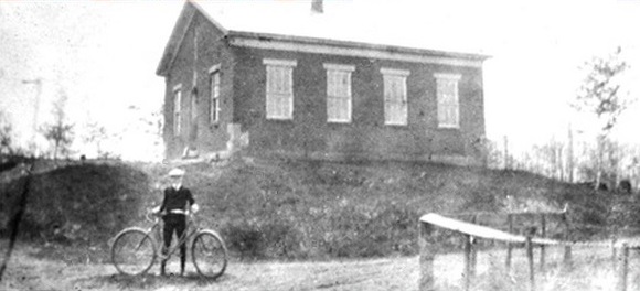
I would also like confirmation that the schoolhouse is indeed the left building in the 1975 aerial
photo below and not the building to the right:
This email message is also attached in the Microsoft Word file ThisOldSchool.doc.
If you have any questions or comments, please do not hesitate to contact me at:
TDBConsulting@aol.com
Thank you all for your time and efforts,
Timothy D. Ball
TDB Consulting
Web: http://TDBConsulting.org/